Target speciesMahi-mahi
Fishing-area strategySurface convergence
Front strength, warm water, productive color, and current boundaries.
 BlueEdgeComing soon to iPhone
BlueEdge for iPhone
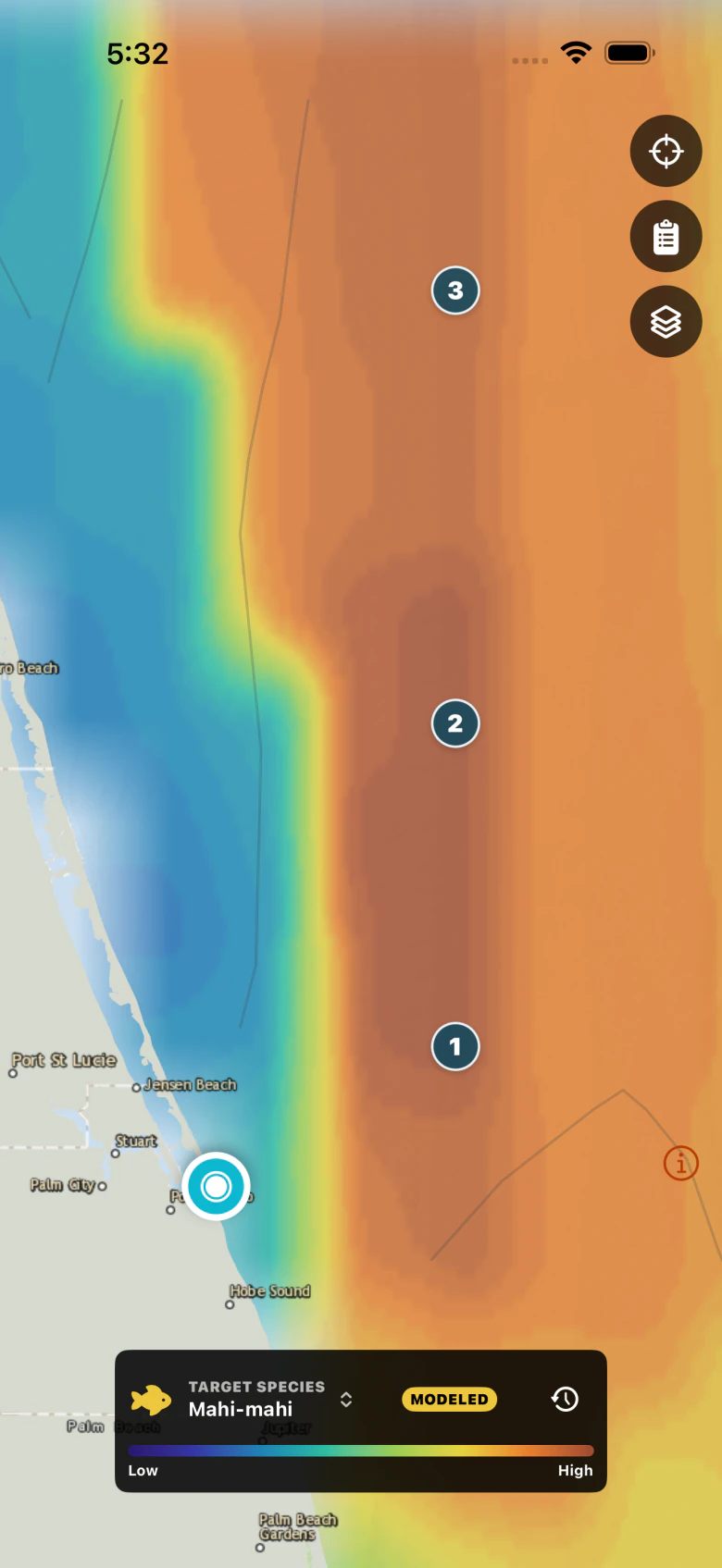
Pick the fish. See the strongest places to look for it.
Mahi-mahi, sailfish, and king mackerel should not produce the same plan. BlueEdge combines temperature, chlorophyll, current, depth, structure, season, and habitat for the species you choose, then ranks the fishing areas to compare from your inlet.
3 days free. No payment required. No automatic conversion.
Specific species + ranked fishing areas
Ocean layers are the evidence, not the answer. BlueEdge starts with a specific target, combines the conditions that matter for that fish, and turns them into a ranked short list of fishing areas you can compare.
Front strength, warm water, productive color, and current boundaries.
Front strength, temperature, shelf depth, and moving water.
Shelf depth, temperature, productivity, and nearby water edges.
Southeast model examples. Rankings estimate habitat fit from available data; they do not observe or guarantee fish.
Use shared habitat traits and seasonal context for the species you plan to pursue.
Evaluate the available ocean layers together instead of treating one colorful image as the answer.
See habitat fit, distance, bearing, and the strongest time window before choosing a destination.
Southeast launch catalog includesMahi-mahi, sailfish, blackfin tuna, yellowfin tuna, wahoo, king mackerel, cobia, grouper, red snapper, mutton snapper, marlin, and swordfish.
The evidence behind the ranking
Inspect the continuous ocean fields, bottom detail, source timing, and uncertainty behind the species-specific result.
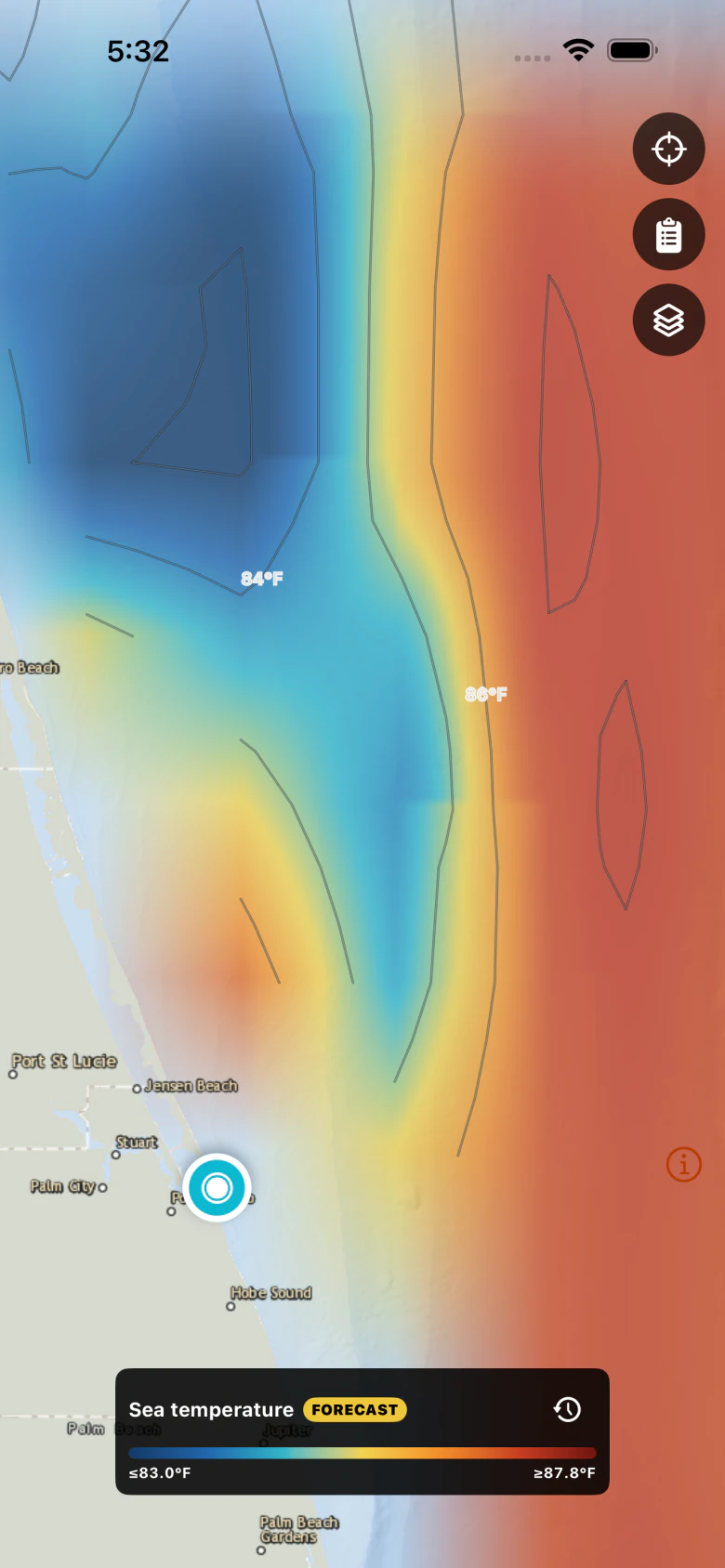
Continuous color, temperature contours, and source timing make warm-water edges readable at trip-planning speed.
From dock to destination
Use a nearby GPS suggestion or select any inlet. It controls routing context, never coverage or price.
Compare ranked areas, layer patterns, conditions, structure, and the inputs behind each score.
Keep the map, route context, and trip guidance available when the cellular signal does not follow you.
More than a satellite image
Choose a target species and compare ranked areas built from shared habitat traits, seasonal context, and the ocean data currently available.
Bring structure into the same view as temperature, chlorophyll, current, waves, and sea-height patterns.
Use GPS-assisted inlet suggestions, then see range, bearing, run distance, weather, tides, and buoy context without buying a separate region.
Save the map and guidance for a planned run so the information you reviewed at home remains available beyond reliable cellular coverage.
BlueEdge labels source times, observed versus modeled fields, gaps, and confidence so unavailable data does not look like a strong recommendation.
Large controls, compact legends, and a chart-first layout keep the map readable for repeated use in bright, moving conditions.
One subscription, every supported coast
BlueEdge is designed for offshore waters along the contiguous United States. Gulf and Atlantic coverage lead the launch, with Pacific coast support included. Hawaii is outside the initial service area.
Your inlet is a routing preference that can change at any time. It does not create a zone, purchase radius, overlap warning, or separate subscription.
Straightforward membership
The free trial is separate from the subscription. It requires no payment, does not auto-renew, and does not convert into a charge.
$74.99/ month
$719.99/ year
$60 per month when averaged across the year.Subscriptions renew automatically until canceled. U.S. prices are shown; the price and terms displayed by Apple in the app are authoritative. BlueEdge has no basic map tier. Before access is activated, the app shows only Membership. The map, GPS, layers, inlet selection, and planning tools do not load until a 3-day trial or paid membership is active.
Before you subscribe
No. Your inlet is used for nearby suggestions, distance, bearing, and trip context. One membership covers every supported launch region.
No. The trial does not require a payment method and does not automatically become a paid plan. You choose a subscription separately.
No. BlueEdge is fishing decision support. Use official navigation charts, current regulations, forecasts, and safe seamanship, and never treat a habitat score as proof that fish are present.
BlueEdge identifies missing or modeled information and reduces data quality instead of silently replacing a gap with a confident fishing recommendation.
Fish the edge, not the ocean